Tisch Spearfishing — a Spearfishing App for the Adriatic

Web
Category
Spearfishing in the Adriatic starts with one question: will you see anything? Tisch Spearfishing answers it with a range in metres and the reasons behind it, not with a star rating. It is the fourth app in the Tisch Fishing family and the first built only for spearfishers, taken from idea and design all the way to release on Google Play and Apple's App Store.
The goal was a tool that doesn't flatter. Every number comes with its source and model run, and the visibility estimate always carries a confidence level and a list of what went into it. The app also keeps score on itself: log what you actually saw and it compares that with its own estimate and tracks its hit rate. If it's wrong, you'll see it.
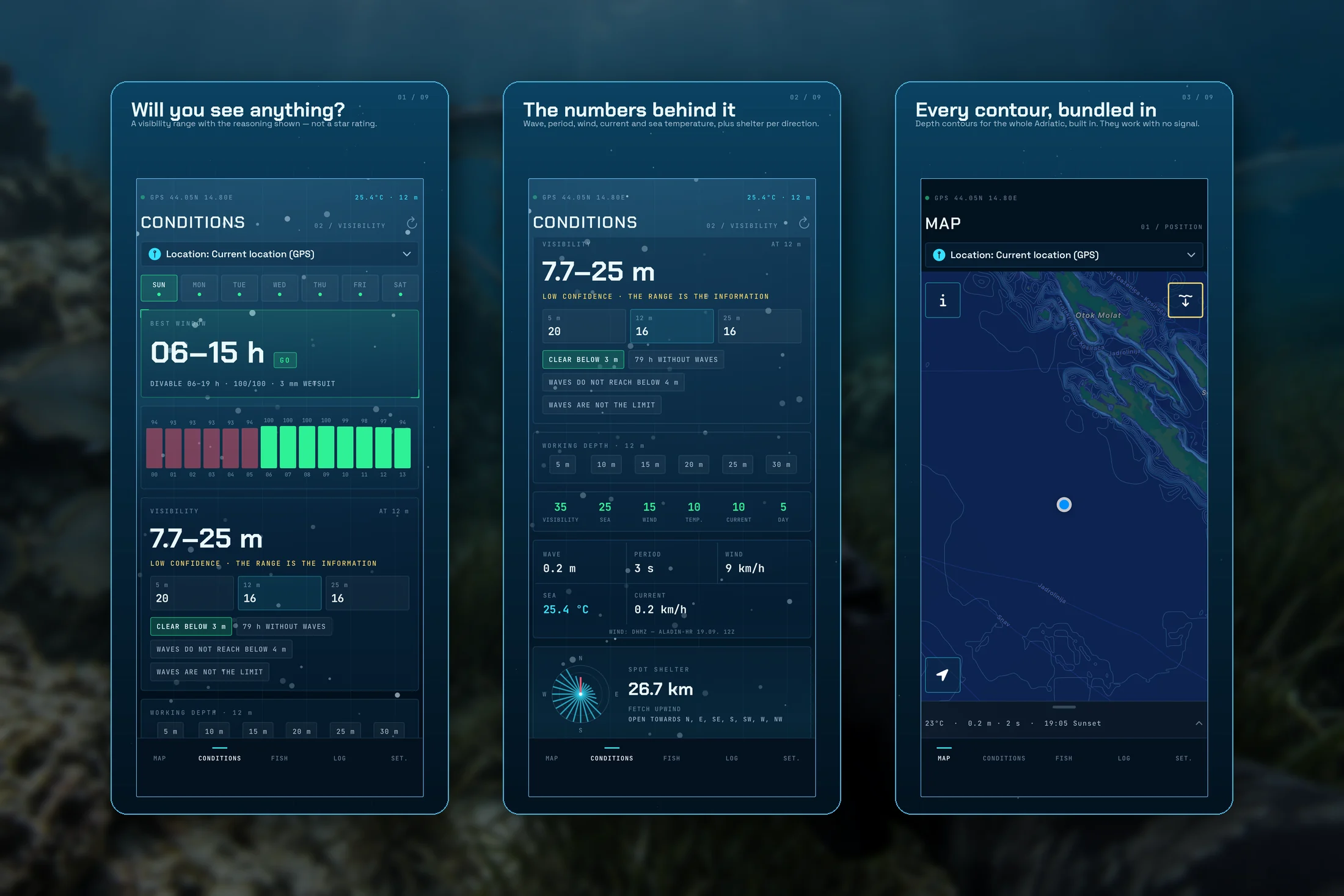
- Visibility, with the reasoning: an estimate for your position, as a range with a confidence level. Next to it: how many hours have passed without waves, whether it rained, and whether the swell reaches your working depth
- Numbers, not a feeling: waves, period, wind, current and sea temperature on one grid, with the source and model run
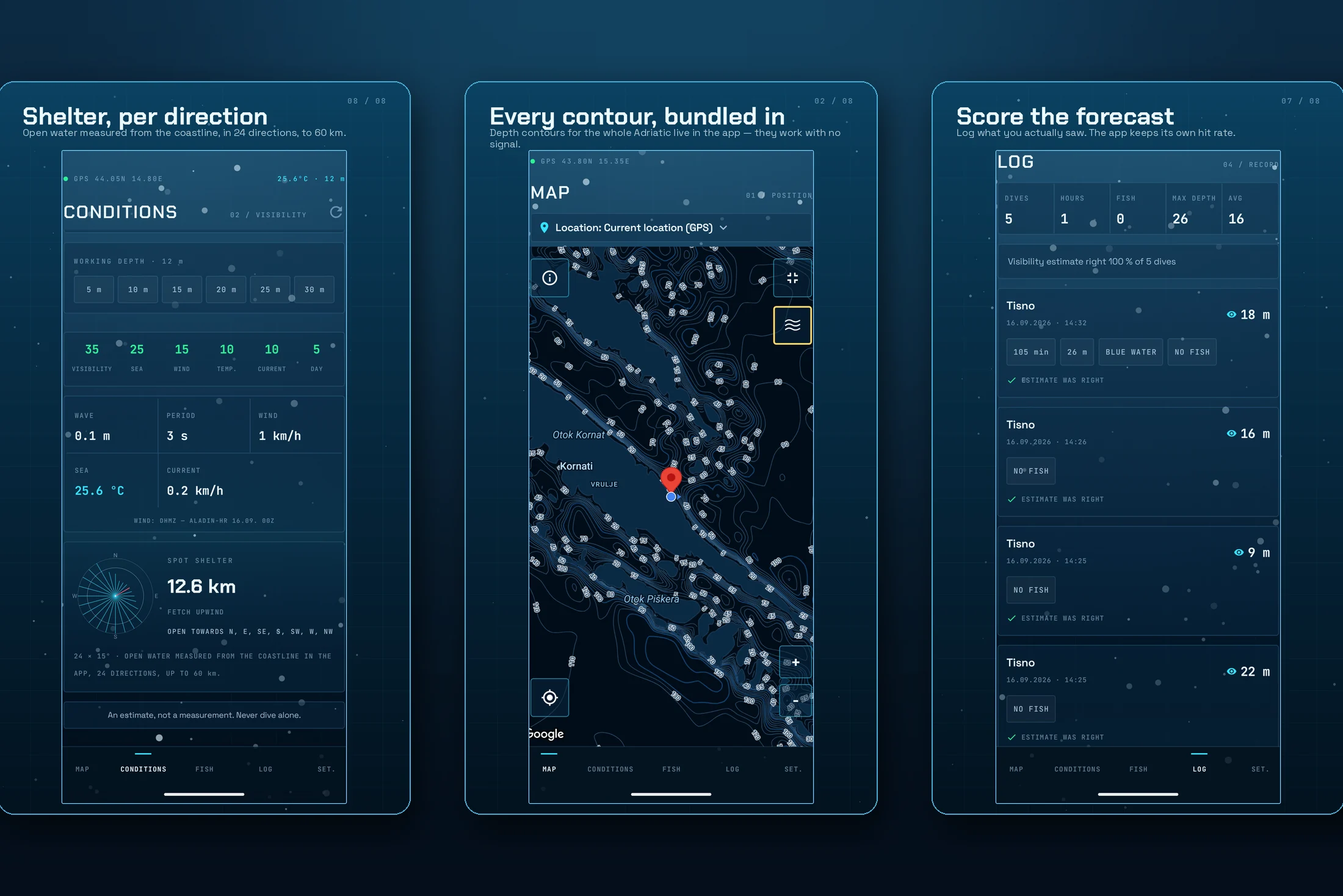
- Shelter by direction: open water measured from the shore in 24 directions, out to 60 km. You see which winds a spot is exposed to and where it's sheltered
- Depth contours for the whole Adriatic, offline: the contours are built into the app and work with no signal at sea
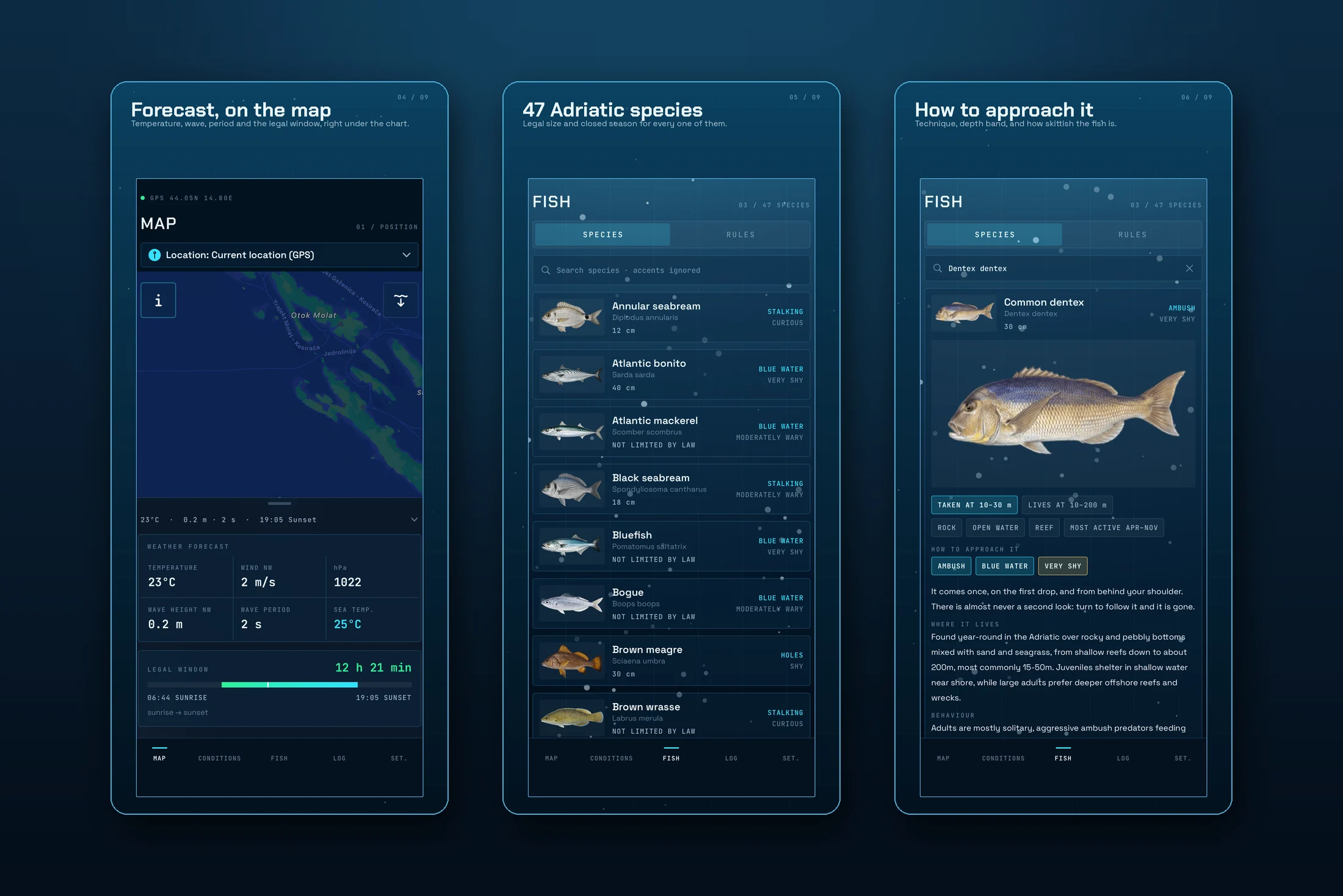
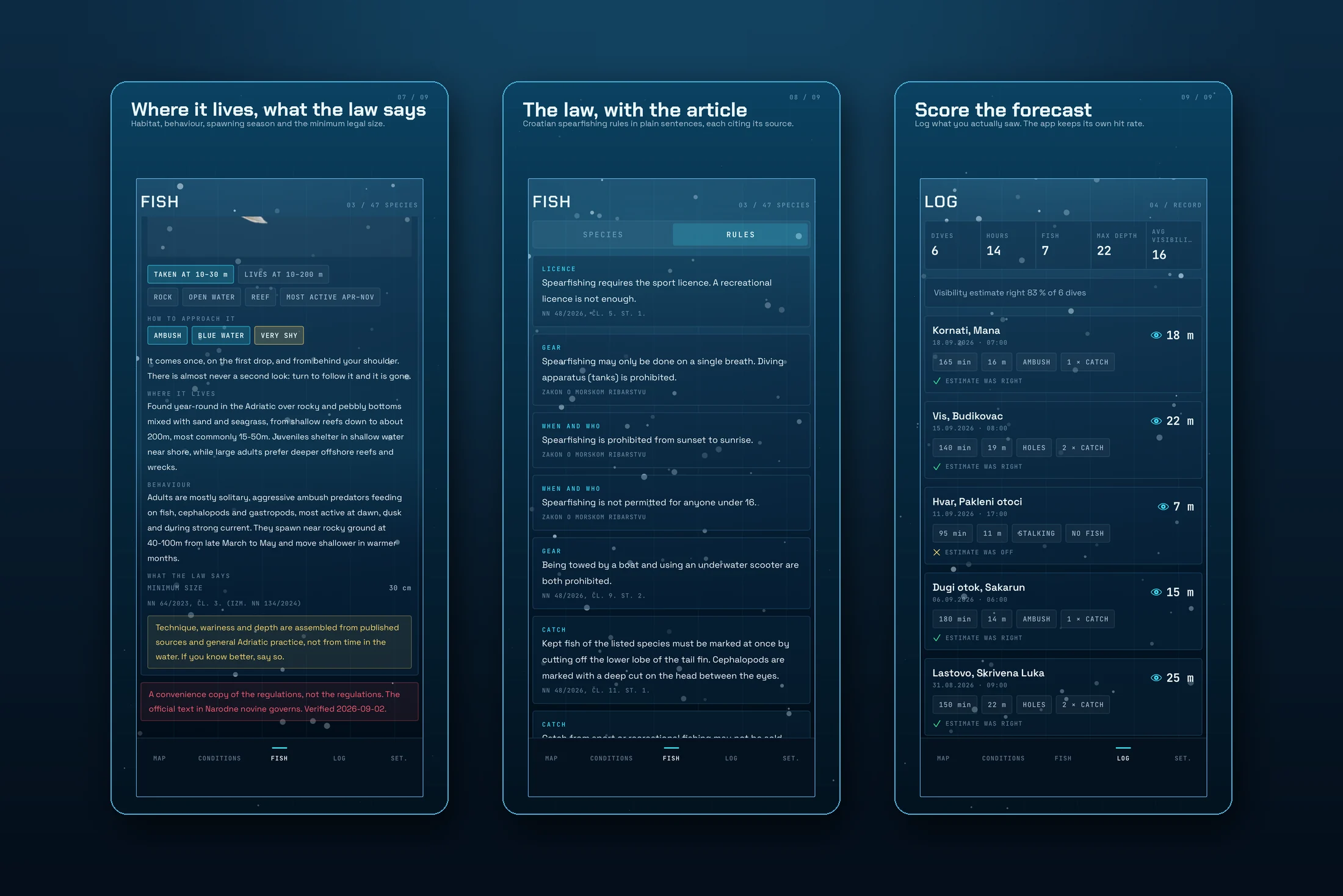
- 47 Adriatic species: minimum legal size, closed season, habitat, behaviour, spawning and how to approach each one (technique, depth range and how skittish the fish is)
- Rules, cited by article: Croatian spearfishing regulations in plain sentences, each with its source and article number
- A log that checks itself: the visibility you actually found, compared with the app's estimate
- Widget: today's conditions on the home screen
- 7 days free, then €19.99: a one-time purchase, with no subscription, renewals or ads
I ran the whole cycle on this project: market and competitor research, the visibility model, turning bathymetry into depth contours that work offline, the shelter-by-direction calculation, a database of 47 species with approach notes, a summary of the regulations with article numbers, the HUD interface, native Android and iOS apps with a widget, a one-time purchase with a free trial, screenshots and copy for both stores, and a promo video.
Technologies: Android — Kotlin and Jetpack Compose, Room, Retrofit, Google Maps with a custom depth-contour layer from an MBTiles file, a home-screen widget and Google Play Billing. iOS — Swift and SwiftUI, MapKit with the same contour layer, WidgetKit and StoreKit 2. Data — Open-Meteo for weather and sea state, DHMZ ALADIN wind through our own server on designer2.org, and EMODnet bathymetry for depths.
An estimate is not a measurement. Never dive alone and always set a buoy.
Download on the App Store (iOS) Get it on Google Play (Android)